


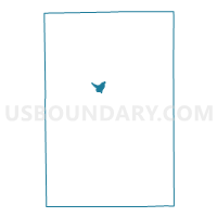
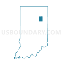
HUNTINGTON 07A, Huntington County, Indiana
About
Outline

Summary
| Unique Area Identifier | 577908 |
| Name | HUNTINGTON 07A |
| County | Huntington County |
| State | Indiana |
| Area (square miles) | 0.92 |
| Land Area (square miles) | 0.88 |
| Water Area (square miles) | 0.03 |
| % of Land Area | 96.42 |
| % of Water Area | 3.58 |
| Latitude of the Internal Point | 40.87055170 |
| Longtitude of the Internal Point | -85.51196520 |
Maps

Graphs
Select a template below for downloading or customizing gragh for HUNTINGTON 07A, Huntington County, Indiana


Neighbors
Neighoring Voting District (by Name) Neighboring Voting District on the Map
- HUNTINGTON 05, Huntington County, IN
- HUNTINGTON 05A, Huntington County, IN
- HUNTINGTON 06A, Huntington County, IN
- HUNTINGTON 07, Huntington County, IN
- HUNTINGTON 08, Huntington County, IN
- HUNTINGTON 12, Huntington County, IN
- HUNTINGTON 12A, Huntington County, IN